Wayne over at
Niches has another
watershed post dated feb 4. (i'd have a link directly to it here if i knew how. scroll down) and
Rurality at
Rurality has one also, as well as
Vicki at
Outside In and
FC (scroll down, he has more than one post on watershed) at
Pure Florida. so i have updated ours with a new picture and maps. i first did one
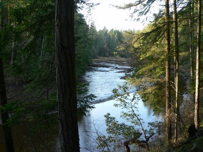
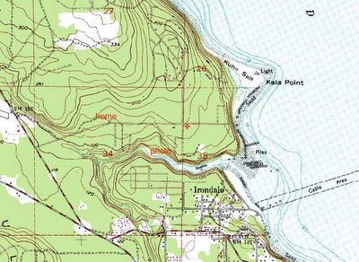
back when, with a picture of chimicum creek at mid tide, looking downstream. the picture above is looking upstream at mid tide. as you can see from the maps below, water falling on our place doesn't have far to go to reach salt water. the first map has "home" and "photo" marked on it. the map is old and things change so the road by "home" (chez bums) is not depicted accurately. the word "photo" is located about where i took the picture on the earlier post, and where the picture in this post was taken.
the mouth of chimicum creek is where i go clamming. just above where it says
Irondale on the map. yes, there is iron ore somewhere close and there was a smelter right on the waterfront.
the red symbol in the center of the map is about where we live.
 Wayne over at Niches has another watershed post dated feb 4. (i'd have a link directly to it here if i knew how. scroll down) and Rurality at Rurality has one also, as well as Vicki at Outside In and FC (scroll down, he has more than one post on watershed) at Pure Florida. so i have updated ours with a new picture and maps. i first did one back when, with a picture of chimicum creek at mid tide, looking downstream. the picture above is looking upstream at mid tide. as you can see from the maps below, water falling on our place doesn't have far to go to reach salt water. the first map has "home" and "photo" marked on it. the map is old and things change so the road by "home" (chez bums) is not depicted accurately. the word "photo" is located about where i took the picture on the earlier post, and where the picture in this post was taken.
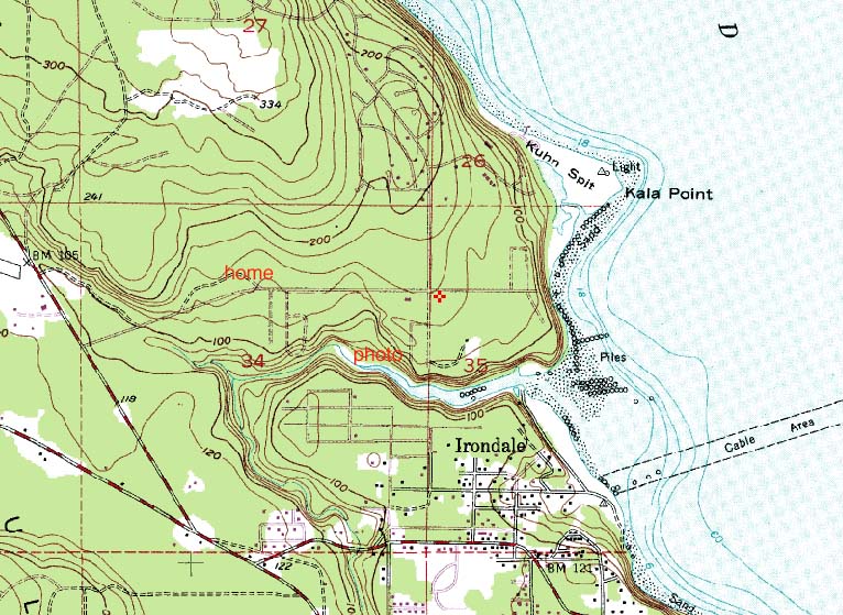 the mouth of chimicum creek is where i go clamming. just above where it says Irondale on the map. yes, there is iron ore somewhere close and there was a smelter right on the waterfront.
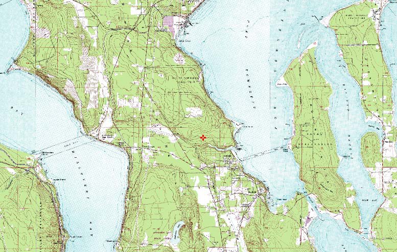 the red symbol in the center of the map is about where we live.
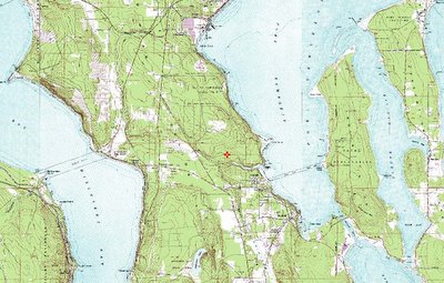
No comments:
Post a Comment